2010 – Silver Lining Tours
I chased with Silver Lining Tours from June 6–11. This trip consisted of my first three tornadoes and some "perfect ten" storm structure.
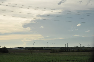
April 26, 2010 – Looking for that Silver Lining
Another graduation, another chase tour.
It’s official: this year’s chase vacation is another whirlwind tour of the Great Plains with Silver Lining Tours. I’ll be on Tour 5, chasing from June 6 – 11, based out of Denver. Chasing with SLT in 2006 was very rewarding – my storm photography since then has never rivaled what I was able to capture on even that marginal chase week.
Plus, Roger is the freakin’ man. I can’t wait to get out there again.
In honor of this event, I updated the entire Suck Zone site, porting over all my posts and pictures from the old blog “Storm Chasing for Dummies”. Now everything is in one place and, more importantly, sorted chronologically for easy reading.
June 05, 2010 – Tour 5 arrives in Denver
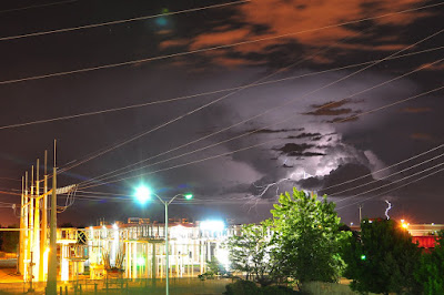
It’s 10:45 PM Mountain Time here in Denver. I’m sitting by the open window in my hotel room. The camera’s shutter is clicking lazily, occasionally capturing lightning in a distant receding storm that has rolled off the mountains. My stomach is full of Country Buffet. It’s going to be a good week.
My non-stop flight to Denver was mostly uneventful. Because I signed up late for the tour, my hotel reservation was somehow missed, but one quick call to SLT co-founder Dr. David Gold and I was all set.
We have a large group this time: 18 people total in three vans. There are a few others my age in the group – Justin, Hannah, and Matt – and I’m looking forward to hanging out with them. Hannah and Justin even came over from Australia; very cool.
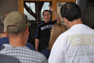
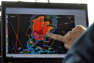
Today we all met up with Roger and he gave us the rundown of what to expect, guidelines to follow, and so on. Roger also shared some of his outlooks for this week, and it is looking better and better.
The next three days are pretty much spelled out for us. Tomorrow we get to sleep in and we can take our time getting to the target area in eastern Colorado, and the next two days find us following the system gradually eastward into eastern Nebraska and Kansas by Tuesday. Wednesday will likely be a travel day as we get into position for the week-end fireworks that are sure to fire up around South Dakota on Thursday and Friday. Roger says the setup for the last few days of the tour is, quote, “absolutely insane”.
This is coming from a guy who has seen 488 tornadoes.
Roger would love to bag tornado number 500 this week – and I’d love to see number one.
Do a rain dance for us.

June 06, 2010 – Day 1 - The Three Little Supercells
- Route map
- Photo gallery
- Trip meter: about 350 miles
- Time: 10 hours
- From: Denver, CO, to Ogallala, NE
- Summary: We jumped around on three supercells in WY and NE and got to punch some cores
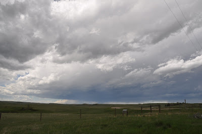
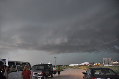
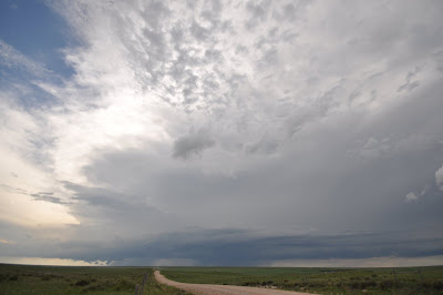
Our first day out with SLT panned out really well and we got a lot more of a show than we were expecting. The setup was originally a slight risk area with some strong upper-level winds and sufficient moisture. The main problem was going to be getting the bases of storms to lower and tap into the good surface moisture that was hanging out below the capping inversion.
We drove just outside of Denver to Aurora at around 11 AM MST, grabbed some lunch, and hung out in a parking lot there watching things develop. What quickly became apparent was that any cumulonimbus towers going up were very high-based (8000 feet!). We were originally planning on playing the Denver Cyclone, an orographic phenomenon that results in a broad low-pressure system around the Denver area. We planned on catching the storms forming on the northern edge of this low, where westerly winds combine with upslope flow to generate lift for new updrafts.
Some cells finally started to get their act together and we drove up north of Cheyenne, WY, and watched the first supercell of the day approach from the northwest. It had a nice wall cloud for a bit, and it even had an RFD cut that spun up a little shear funnel (non-tornadic). We went further east on I-80, punching the core of storm one as it crossed the interstate. Wow, there was some intense hail and wind in that one. Just wait until I post the video from that!
Then we went north of Burns, WY to watch cell number two. This was a cute cell that put out a lot of CG lightning but didn’t do much else. It was pretty photogenic as well. Roger yelled some obscenities at it to try to rile it up, but to no avail. We got back on the road.
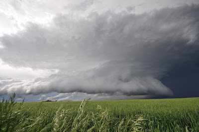
By now, things were going bonkers east and south of us, so we hopped back on I-80 East. We crossed into Nebraska and contemplated our options. Cell two moved south of the interstate and intensified a fair amount. I don’t remember exactly, but there were soon some tornado-warned cells south of I-80, and a line of three discrete severe supercells up ahead to the northeast. The southern cells were beginning to converge and snuff each other out, so we went for the north option. Also we could see the upcoming third cell had a nice low base and some suspicious lowerings.
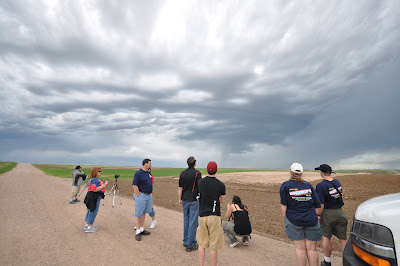
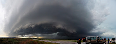
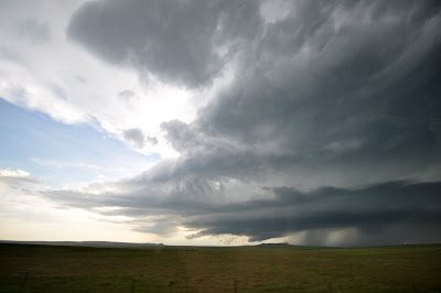
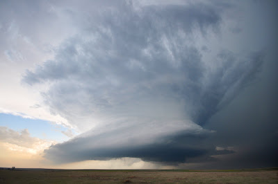
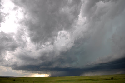
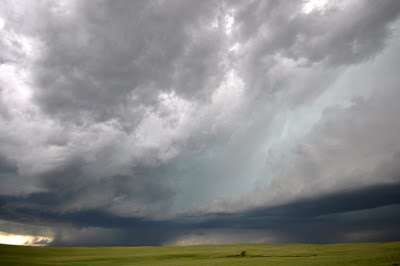
We trucked north at Sidney, NE (“America’s favorite stopping place since 1867”) towards the cell and we could make out some amazing structure as we got closer.
The pictures almost tell the whole story, there. What they don’t show was the rapid cloud movement as the storm quickly advanced and scud rose up right into the base. We stopped briefly to admire the Libery Bell base and the inflow bands that stretched on for miles. It was really something else. Storm of the day, right there. Three’s a charm!
We stopped in Sidney for a bathroom break and then busted east again, but the storm crossed the interstate before we were able to get in front of it. We passed under the rear flank core and right under the mesocyclone of the storm, pelted by golfball hail and winds recorded at 80 MPH. You could look straight up and see the swirling of the base as it was happening. That storm was rotating hard, but luckily did not produce anything on top of us. We has a brief period of calm followed by the forward flank downdraft and the hail and rain accompanying that!
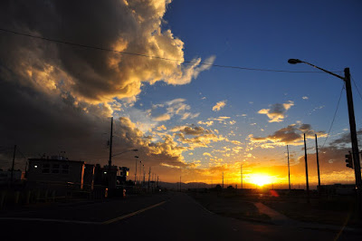
Daylight was beginning to fade and the cells were becoming a mesoscale convective system (MCS) – basically an unorganized mess of storms. We arrived in Ogallala, where Roger had booked our hotels earlier in the day, and had dinner and were treated to a spectacular sunset that you can only find on the Great Plains.
As I was walking into the combination Taco Bell / KFC, I literally ran into Ari Preston, a fellow NOAA Hollings scholar who I had interned with in Norman last summer! He’s been out with VORTEX2 with the University of Michigan, and V2 is staying in Ogallala tonight as well. We had dinner and caught up. I found out that he “shared an elevator with Dr. Forbes” and that Mike Bettes is a really cool guy in person. V2 wraps up next week, and it sounds like the whole lot of them are pretty tired and frustrated at this point in the season and just want it to be over.
Today was a fanatastic first day with a lot of fun little surprises. We got to see some nice structure, some severe hail and wind, and got to experience a mesocyclone up close and personal. We didn’t have to drive very far, and we are in great position for tomorrow’s action along the KS/NE border, as well. Thanks to Roger for making the best of our so-so positioning today. I’m looking forward to Forecasting 101 tomorrow morning in the Days Inn lobby.
I’m beat. Check out the photos, and I’ll deal with the videos next week when I’m back. You’re going to have to wait to hear that hail we drove through.
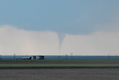
June 07, 2010 – Tornado!
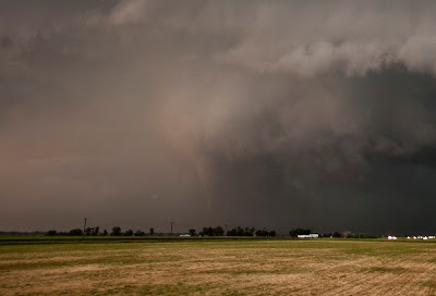
Photo courtesy of Roger Hill
- Route map
- Photo gallery
- Trip meter: About 470 miles
- Time: 10 hours
- From: Ogallala, NE to Ogallala, NE
- Summary: Tornado virginity taken by a rain-wrapped cone approaching at 40 MPH from 1/2 mile away
Finally.
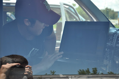
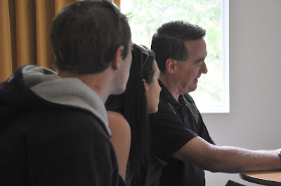
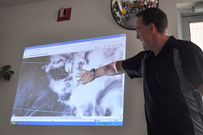
We took our time again this morning. Hannah, Justin, and I got to sit in with Roger for about an hour to pick his brain as he explained his daily routine for checking the weather models and making target forecast fot the day. Then we did a little Weather 101 lesson on the Days Inn lobby with the whole tour as he went over the basics of supercells and severe weather forecasting.
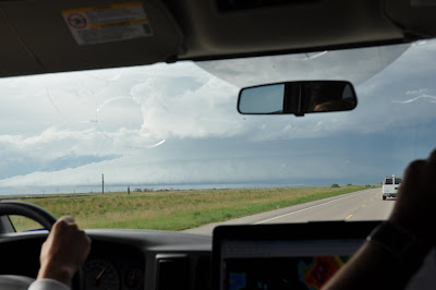
Then he went over the day’s forecast. Outflow from an overnight MCS was set to meet up with a warm front approaching east of a surface low in NE CO. The warm front was to bring high temps in the 90s and provide the lift necessary to break the nuclear cap. We left for Fort Morgan at about noon.
We stopped at Fort Morgan and watched in awe as dewpoints were rising rapidly. 82 over 66 was a typical temperature-dewpoint spread in eastern CO, which is a phenominal environment for supercells. We decided to go further north for lunch in Kimball. VORTEX2 was there as well and we were picking them up on the radio.
Well, storms started firing way north where the cap was quickly weakening and instability was more than sufficient. We went north of town and sat for a while, considering our options. North was looking too good. V2 had the same idea. The whole armada cruised by going north towards Scottsbluff, and we followed suit.
We meandered through Scottsbluff and the national monument (beautiful) and went north towards our first cell of the day. Storm motion was pretty brisk, about 35-40 MPH. We sat for a while in Torrington and watched it develop.
However, our cell was gusting out and quickly dying. You could see that the outflow was kicking up dirt along the ground and cutting off the inflow. We drove back east in front of the storm. It looked like our day was done.

But there was One More Thing.
This little cell that had popped up along the outflow of our storm suddenly showed great structure and was intensifying quickly on radar. Meanwhile our storm was choking itself off and petering out.
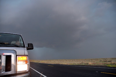
We sat directly south in sight of both cells near Torrington, with Roger trying to make up his mind. “Let’s stop here for a second. I just want to see one more radar scan.” That was all he needed to see, and we quickly got on the western storm. Surprise: V2 did, too. The storm had taken a hard right turn and was diving southeast right along our road, Route 26.

We booked it back west and tried to find a north road option. With the heay rain now wrapping around the mesocyclone, the storm was taking on a high-precipitation (HP) characteristic, and the only way to see a tornado would be directly to the east of the cell, in the “notch”. We went back to Scottsbluff and took Route 71 north to get a good look.
This storm was a beast, without a doubt. It was churning through the air and blasting everything in its path with severe wind and gigantic hail.
With that special tone in his voice, Roger informed us it was time to leave. Now. The thing raced us back south as we skirted around Scottsbluff. The core of this thing was green as a gemstone.
Wait, what? Tornado warning? On the ground? Indicated by a trained spotter? There was no way anybody could see a tornado back in that mess. Roger was skeptical. We stopped east of town on Route 26 alongside a V2 DOW and got out. “Stay near the vans! Don’t go wandering off!”
We squinted into the churning gullet of this cell, which was completely obscured by precipitation. Then Justin though he saw a power flash. Then I saw a bright green power flash. Then Karen yells, “tornado!” aaaaand it’s time to go.
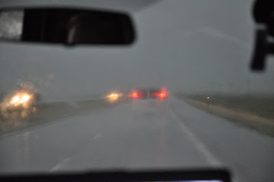
Buried deep in that downpour less than a mile away was a large cone tornado headed directly for us. We couldn’t see it until it was nearly on top of us. I didn’t have time to take pictures, but the video captures it all. We trucked along Route 26 west of Scottsbluff as the tornado was about the cross the road perpendicular to us. The RFD really picked up and rain pelted the van as trees and grass bent over under the wind. At this point the tornado was nearly on top of us. It was probably only a half mile away and yet we could barely make out the outline of the funnel.
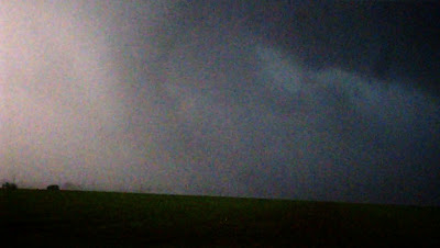
Roger screamed on the radio as we then busted west and the tornado was bearing down directly behind us. “We’ve got to move! Quickly! Really quickly! There’s a cone tornado in there, I can see it!” We did our best jockeying around other cars caught in the mess, trying to keep the SLT convoy together.
—he
After a few more miles we were clear of danger. We stopped a few more times and let the storm catch up to us as we took some more pictures. Lightning activity picked up as the cell finally gusted out and merged into a giant linear system that raced us all the way back to Ogallala. Ogallala, of all places.
I don’t even know how to feel right now. Exhaustion. Accomplishment. Exhiliration. It’s all flooding over me. I think it may take a day or two to fully sink in. Until then, enjoy the pics, and I will try to get some video up soon as I can.
9:30 tomorrow! Let’s do it! Again!
June 08, 2010 – Surprise!
- Route map
- Photo gallery
- Trip meter: about 440 miles
- Time: 12 hours
- From: Ogallala, NE to Limon, CO
- Summary: A near-bust ends with a tornado-warned supercell at dusk in eastern CO
- Interesting town names: Last Chance, Punkin Center
Whee! Today was a long day that ended with a nice treat.
I won’t go over the forecast, but it is sufficient today that the setup was marginal at best. There were two main plays: eastern CO and western KS / eastern MO. Well, there was no way we were driving way out to Missouri just to drive back to Colorado tomorrow. It’s a good thing, too, because the Kansas storms, while tornadic early on, quickly morphed into a giant linear unchaseable mess.
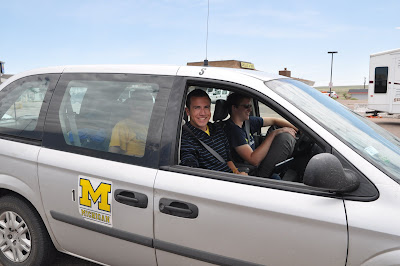
We went south from Ogallala on I-76, again to Fort Morgan, but this time we went due south. We had lunch in Limon, CO, where VORTEX2 had again taken over the town. I sought out the University of Michigan crew and again found Ari and his peers in the UMich scout van, and we got to shoot the breeze a bit before heading out.
Then we went south all the way to Pueblo. We stopped a few times and almost turned around back north towards the slightly better air, but finally ended up in Pueblo with nothing to show for our travel except some stupid stratocumulus clouds. Our hotel was booked back in Limon, CO, so we were to head back there after dinner in Pueblo.

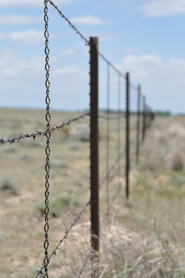
Let me tell you, the stretch between Fort Morgan and Pueblo was some of the most remote, desolate land I have seen in a long time. There were blink-and-you-miss-it towns with populations in the dozens. There are no real crops to speak of – just wide open land, some barbed wire fences, and the occasional cow. The sign at the start of Route 71 south proclaimed “NO GAS FOR 75 MILES”. Yikes.
But I digress. As we were trying to figure out how to pay the bill at Cracker Barrel in Pueblo (mmm, meat loaf), suddenly everyone was gone. Roger had taken once look at the sky, and that was all he needed to change his mood from indifference to childlike excitement. There were some storms forming off the Palmer Divide and we booked it back north in the event that one survived.
Well, one cell was able to take over, and boy it was a beauty on radar for a few scans. It had a nice updraft and a low shelf cloud that we could make out as we got closer. It had moderate rotation and even a tornado warning due to a sheriffnado – a tornado reported by law enforcement. Now, we had been watching the cell the entire time, and while there were many suspicious lowerings, they were ragged, and there was no way a tornado had dropped out of that storm.

We stopped for a bit to photograph the storm, but light was fading quickly and it was very tricky. As it turns out, the NWS had also issued the warning based off of a video feed on Severe Studios from none other than Bill and Anna Stromberg, who were driving with us in van #2. Again, there was no tornado on this storm, but with a low-resolution streaming video, it is understandable how scud could be mistaken as such. Roger tried to convince the NWS that they were in the wrong, but it took a call from Bill and Anna to set things right.
The storm took a hard right turn and dove southeast as it intensified, and it crossed Route 24 right alongside us. The result? We got to drive through both the rear flank and forward flank of the storm. For a good 10 miles we dealt with heavy rain, marble- and ping-pong-ball-sized hail, and gusty winds. You could barely hear yourself think from the sound of hail pelting the van, and I commend our driver Matt and the other drivers for safely maneuvering through that storm. Visiblity could not have been more than 50 feet in front of the vans, even with high-beams on. You’ll have to watch the videos I post later to get the full effect. Route 24 paralleled the storm and took us straight back to our hotel reservations in Limon.

So, there you have it: a marginal day almost busted, but in the end produced a nice, marginal supercell – the best in Colorado for today, and we were lucky enough to see it… really closely! I’m quite happy.
Tonight we got in pretty early – 9:30 PM – so we got a chance to relax a little and hit up the local establishment across the street to have a few drinks and share some storm stories with the locals and some other chasers. Also, Justin kicked my butt at pool.
Tomorrow, well, that’s a totally different story. Roger has had this excitement in his voice whenever he speaks of the last days of this chase tour, and starting tomorrow we can expect a lot of great action in the CO / KS / NE / WY area.

June 09, 2010 – Van no-go
- Route map
- Photo gallery
- Trip meter: about 400 miles
- Time: 13 hours
- From: Limon, CO to Ogallala, NE (again!)
- Summary: We had once chance and caught the only big cell in the tornado watch
Today was the chase day that almost wasn’t.
We spent most of our day traveling north from Limon towards better instability. We stopped for a while and had lunch in Fort Collins, then stopped again the rest of the afternoon in Pine Bluff, NE.
Big cells popped up in Nebraska way off to the northeast, and we targeted them as we stopped in Pine Bluff for what was supposed to be a quick gas and bathroom stop. The gas station attendent was high as a kite and took forever to process the gas payment. By the time the numbers had worked through his pony-tailed skull, those cells had rapidly weakened on radar. We decided to stay put for a few hours.
Skies were clearing and it looked like nothing would develop. Finally, the atmosphere destabilized enough directly to our north and some blips appeared on radar. We drive a few miles east to Kimball to sit just a little longer.
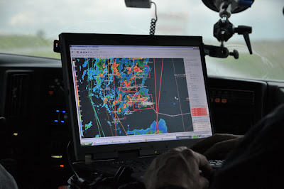
Roger came on over the CB radio. “We only have one chance today. I want to wait for just one more radar scan, folks. If this storm intensifies, we’re going for it.”
We waited. The new scan came in, and it looked favorable. “Let’s go!” The chase was on. Vans 1 and 3 began to pull out of the parking lot. Bill turned the key of Van 2, and nothing happened.
He turned it again. Still nothing.
He reached for the CB mic. “Roger, van 2 won’t start.”
Roger came back, “Are you kidding?”
And that was the death of van 2 for the day. The van had electrical power, and they tried jump-starting it, but the engine was not even turning over. Meanwhile, we were watching the storm in the distance go absolutely ballistic. The backlit updraft tower was rock-solid and completely vertical, and soon formed an anvil. I was literally pulling my hair out watching this happen as van 2 sat stranded.
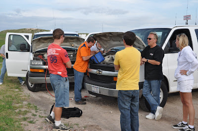
Luckily, Dr. Dave Gold had shown up in his SUV, and the eight occupants of van 2 piled into the other vans and Dave’s car. We left the van in a dirt parking lot and were off chasing the day’s only cell.
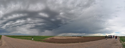
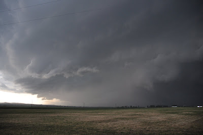
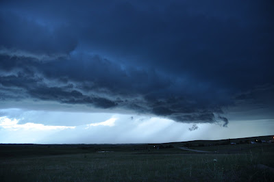
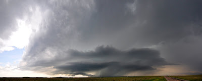
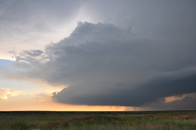
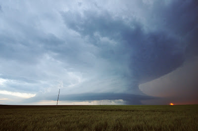
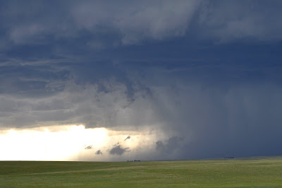
As we approached, it was apparent that this was a nice supercell with textbook structure. However, it was sucking in a lot of scud and had the apperance that it was ingesting cold air. It had a great lowering that soon got its act together and resembled a healthy wall cloud that was rotating broadly.
This was an exceptionally beautful cell. The large updraft base was matched by the heavy precipitation pouring down the forward flank downdraft. Mid-level winds sculpted the updraft into two stacked plates. The ragged wall cloud was constantly shifting its shape and ingesting cloud after scud cloud. It was really mesmorizing to watch the whole storm mechanism work as a whole, as if it were a piece of precise yet powerful machinery.
As the forward flank downdraft ramped up and began dumping rain and hail, you could watch as the cold air was striking the ground and being sucked back up into the updraft. The upward motion was very rapid, and if it had been timed with an RFD downburst, a tornado would likely have resulted. However, the RFD never came, and within five minutes the cold air had completely choked off the updraft and the wall cloud completely disappeared.

Roger took van 1 into the core to try to pick up some big hailstones for Boeing, but there was nothing larger than golfball-sized and he abandoned this mission. We met up back at the broken van and transferred our luggage, had dinner in Sidney, NE, and made out for (surprise!) the Days Inn of Ogallala.
We’re crammed in the van on the way there now. The tornado watch never really panned out, and we got the only big storm to go up in the entire watch area. While today didn’t turn out to be a phenominal severe weather day, it couldn’t have turned out any better! We got some great pictures of a very photogenic storm, and were very lucky we didn’t miss the storm completely with the mechanical difficulties.
Tomorrow looks to be a great day, so I hope they can get van 2 fixed in time.
June 10, 2010 – Tornado duo
- Route map
- Photo gallery
- Trip meter: about 400 miles
- Time: 14 hours
- From: Ogallala, NE to Sidney, NE
- Summary: A monster cyclic supercell dropped two beautiful cones and roped out beautifully
Today will stand for a long time as the most incredible day of my storm chasing career.
We sat in Sidney for lunch and waited and waited and waited for something to happen. Roger and Chris retrieved van two from Ogallala, where its starter had been replaced. We didn’t leave until about 4 PM, and we booked it west and then south on Route 71, again passing the foreboding “NO GAS FOR 75 MILES” sign. We stopped and observed one supercell on the CO/NE border, but it was nothing special.
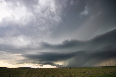
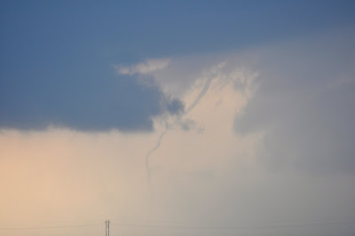
Storms were going bonkers further south, and so away we went. There were a few superells in a line and none could keep its structure, except for one. This southernmost cell in the cluster is known as a “tail-end Charlie”. On radar, it was a beast.

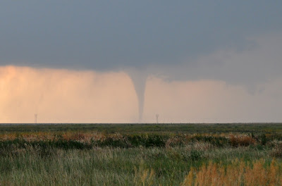
At about fifty miles away, we could make out the smooth updraft base of the cell. Suddenly a small protrusion appeared out of the bottom and began extending towards the ground. Very quickly, this funnel reached towards the ground in a classic cone shape. Tornado number one of the day was on the ground, and boy was it a beauty. Backlit by the setting sun, the high-contrast funnel was clearly visible for miles around. It sure beats the rain-wrapped thing we saw earlier this week.
We couldn’t stop driving to take pictures, because this cell was ramping up and was only just starting its show! Tornado one lifted very quickly without roping out, just rising straight back up into the wall cloud after being on the ground for a few minutes.
Much closer to the cell we got a chance to stop amongst the horde of chasers and VORTEX2 vehicles, and before long the supercell cycled and dropped its second tornado. It had nearly the same appearance as the first tornado, though it grew wider at the base. Absolutely stunning.
Tornado two was on the ground for a few minutes more and then gracefully roped out. We nearly missed the rope-out stage because the funnel was so skinny.
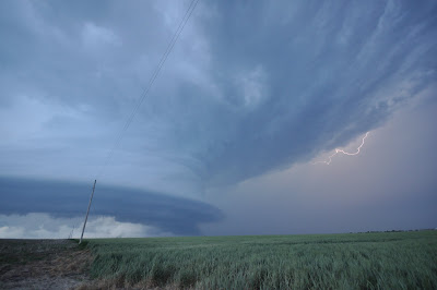
The cell chased us back east as we stayed in front of it, stopping a few times to take in the beautiful storm structure. It may be a long time before I see another supercell quite this well-organized. The entire motion of the storm was absolutely intense, and its rock-solid appearance was stunning. Roger called it the “best structure of the year”, a “nine out of ten” supercell.
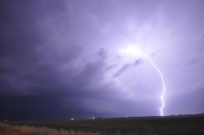
As night fell, the lower-level jet ramped up and began feeding this storm even more. As we trekked north and east around the forward flank core, there were at least two more tornado reports back on the rear flank where we could not see. As we got in front of the cell we were treated to a fantastic light show as near-constant lightning lit up the whole updraft and underside of the storm. You could make out every piece of storm structure even in the pitch black. It looks like daylight in my photos, but only because there was so much lightning going on. Phenominal.
Roger and the guides keep going on about how people get addicted to storm chasing and keep coming back year after year.
Now I know how that feels.
I don’t even know what else to say beyond this point. The photographs are the true storytellers today.
It’s almost midnight now, as we head back to our hotel in Sidney. We stopped at a gas station for dinner, and I bought a sandwitch composed of some chicken product and cheese product crammed between two pieces of bread product and stuck under a heat lamp all day.
It was the most incredible dinner I’ve ever had.
June 11, 2010 – MCS = Mess of Crappy Storms
- Photo gallery
- Time: 12 hours
- From: Sidney, NE to Denver, CO
- Summary: Chased one cell south of Denver that became HP and never recovered
Not a whole lot happened today. We hung out alngside VORTEX2 in Limon, CO for lunch. I got to introduce myself to Dr. Bluestein, which was pretty exciting. As Roger and David were talking to Howie, Chuck Doswell also came in for Subway. It’s nice to see that, amongst all the chaser hordes that crowd the roads these days, long-time chasers can still meet up like they’ve been doing all these years. It makes me wonder what the chasing community will look like in twenty years, when we are the old-timers that others look up to. Will chasing continue to explode in popularity, as it did following the release of Twister and the TV show Storm Chasers? Or will our numbers dwindle as people realize the hobby isn’t as glamorous as the media makes it out to be?
But I digress. I sat with David during lunch and he went over his forecasting methods and his predictions for the day. What he saw was a large number of storms erupting simultaneously, because the cap was present, but very week. Typical afternoon heating to temperatures in the low 80s would be sufficient to overcome convective inhibition (CIN).
Well, his forecast panned out, and soon a nice storm was tracking over the Denver downtown. There was a report of hail six inches deep on the ground, closing I-70 west of the city. It was the first tornado-warned cell of the day, and we went after it.
However, soon its radar appearance was unfavorable, and we decided to chase a fresh cell to the south that was rapidly intensifying. VORTEX2 decided the same thing.
We positioned in front of it and watched it for a while. It was pretty and had a deep green precipitation core full of hail, but it was not terribly organized.
It had some nice rotation to the base, but eventually the precipiation took over and the cell took on a high-precipitation characteristic.
The cell chased us back to Limon (again) and we decided to bust north on I-70 through the core to try to reach a new cell further north. We were going 30 MPH on the interstate with zero visibility and strong winds. Hail covered the ground in huge piles that looked like melting snow. Even now, driving back north to Denver a few hours later, the shoulders of the road still have a few inches of hail. Well, Roger changed his mind, and we went back south and then east to try to get back in front of the Limon storm again, because it was looking better again on radar.
Well, that all changed. As we got close, it was clear that the cell had not recovered from its initial core dump and had no chance of producing any tornado. It was also merging with a new cell that was slamming into it from the south. It was becoming dark and late, so we threw in the towel and are now making the two-hour trek back to Denver.
So, today was a bit of a downer, but after yesterday’s incredible experience, I think any day short of an outbreak would have been disappointing. At least we didn’t miss much of anything. That Denver cell we abandoned apparently produced a short-lived tornado, and some out-of-reach cells in Kansas were also quite active, but despite all the tornado warnings and tornado “reports” from the public and spotters, there was not much to see here.
So that’s that. Tomorrow I get to screw up my sleep cycle again by flying back home. My summer job starts on Monday. I’ll have a wrap-up post tomorrow, and in the coming weeks I’m going to put together all my video into a presentation.
June 12, 2010 – Tour 5 conclusion
So, there you have it: three vans, six days, more than 2000 miles, nine supercells, and three fantastic tornadoes. The best part of trip, however, was the time spent with two dozen people who share my passion for chasing and observing severe weather. Whether crammed in tour vans backtracking roads we’ve seen before, or congregating at the truck stop in Limon, CO, I always had great pleasure talking and spending time with everyone on the tour.
I especially commend Roger, David, and our drivers Matt, Chris, Bill, and Anna. Everyone kept us safe and did a great job driving through some of the planet’s worst weather. Roger’s decision-making ability really came through this year – just like in 2006 – when making the right call meant the difference between a bagged tornado and a busted chase. Roger also handled the van break-down very well, keeping himself composed, methodically troubleshooting, and then ensuring that everyone was still able to see storms that day.
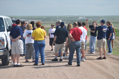
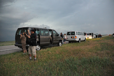
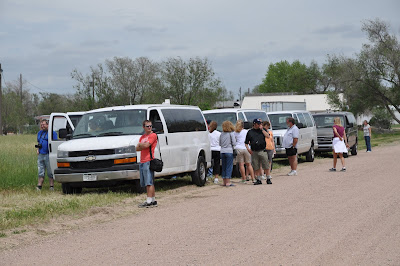
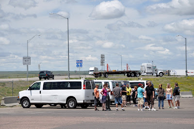
As much as I enjoyed seeing monster supercells and my first tornadoes, there was a lot to look at on the ground, too, if you remembered to look down. I’m talking about chaser convergence. By early afternoon, sleepy interstate towns quickly become overrun by vehicles festooned with antennas, and instruments. Lines grow outside restrooms and fast food counters as the camera-clad hordes prepare, not knowing when they will leave or when they will have the next chance to stop.
Outside, mobile doppler radars gas up as some grad students toss a football with their professor. One of the DOWs breaks down again and is towed away. Other students work on the mobile mesonets, cleaning windshields and scaling hail-dented minivans to repair weather instruments. A film crew records the scene as filler footage for a documentary. A bearded man dons an orange jumpsuit, knee pads, and some sort of harness. He stands beside a lifted black truck outfitted with hail guards and an IMAX camera mount. Bull horns mounted on the grill complete the ensemble. Whoever gave this guy an IMAX camera must be out of their mind.
Meanwhile, sitting alone in the corner of the rest stop is Howie Bluestein. He spreads tuna on some bread as he looks over the surface observations and model output on his MacBook. Roger Hill and David Gold go over to say hi, just as Chuck Doswell walks in and pats David on the back. These old-timers have run into each other in tiny Great Plains towns for so many years, and will continue doing so until they’re no longer physically able. Come the end of the chase day, they will gather in local establishments and share fish stories of gorilla hail, mile-wide wedges, and the one that got away.
This is the real chasing community, the one that will still be here when the thrill-seekers and television cameras are gone. For a few weeks of the year they are nomads, roaming the Great Plains anticipating the next storm that will be unique from the hundreds they’ve seen before. They will find these storms and chase them, because there’s always one more day to forecast, one more storm to chase, and one more tornado to tally.
And there’s always next year.
